Cobreorco
Copper | Gold
Location:
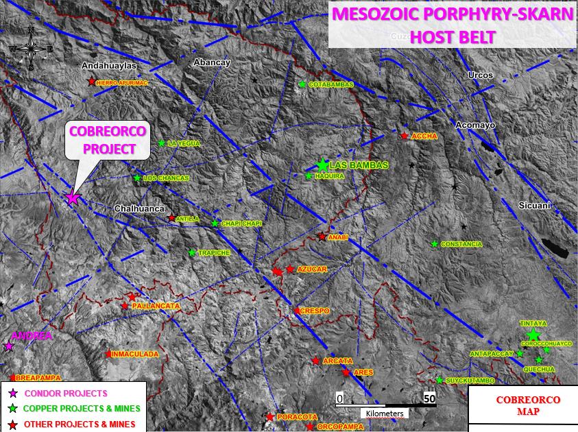
Cobreorco is located in south-central Peru, in the province of Andahuaylas in the department of Apurimac, at elevations of 3,700 to 4,100m. Cobreorco is approximately 90km north-east of the town of Puquio, and approximately 120km west of the Las Bambas mine.
Ownership:
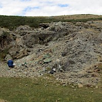
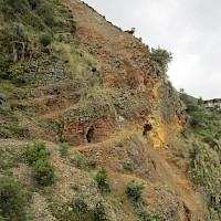
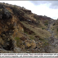
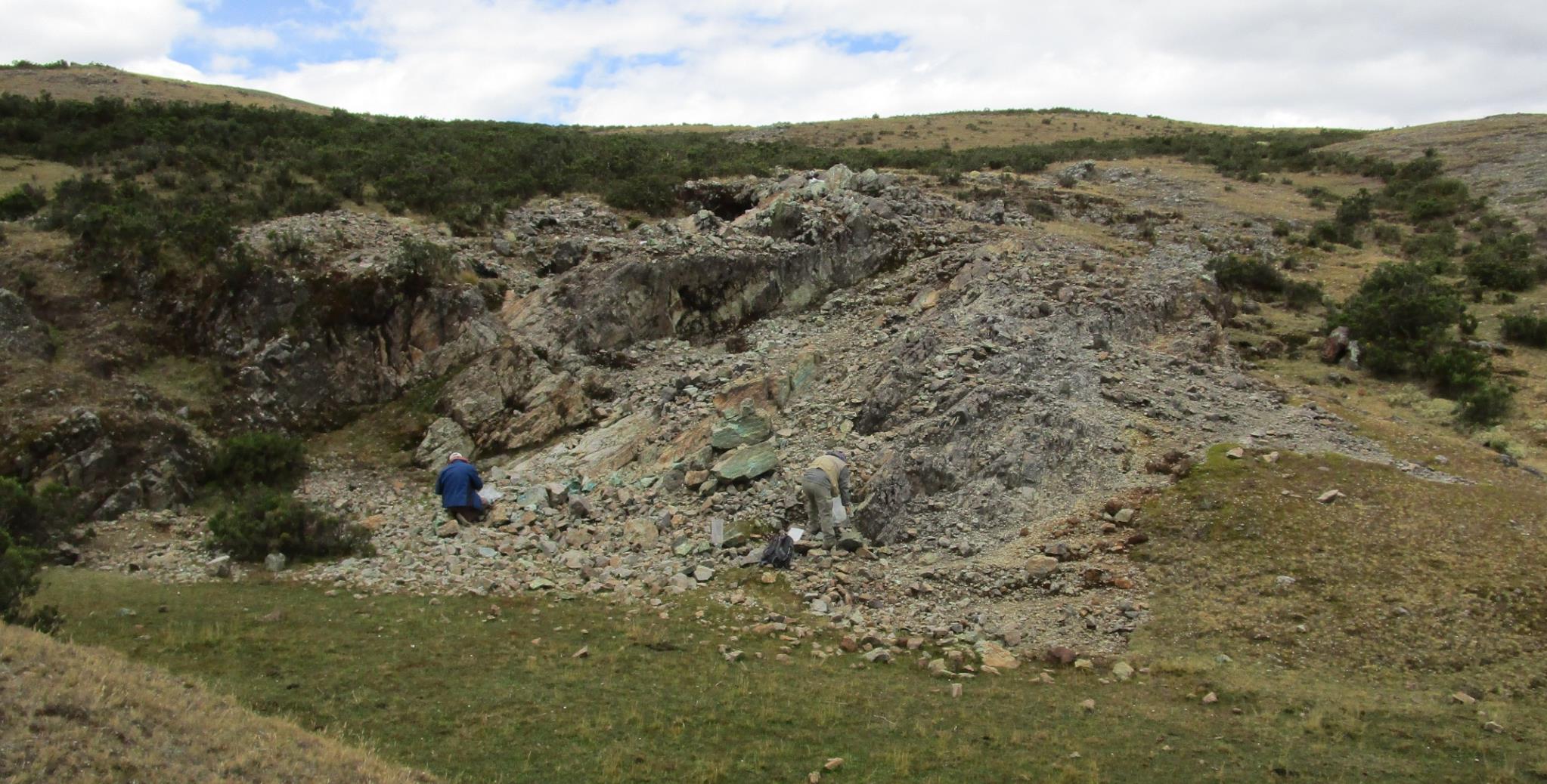
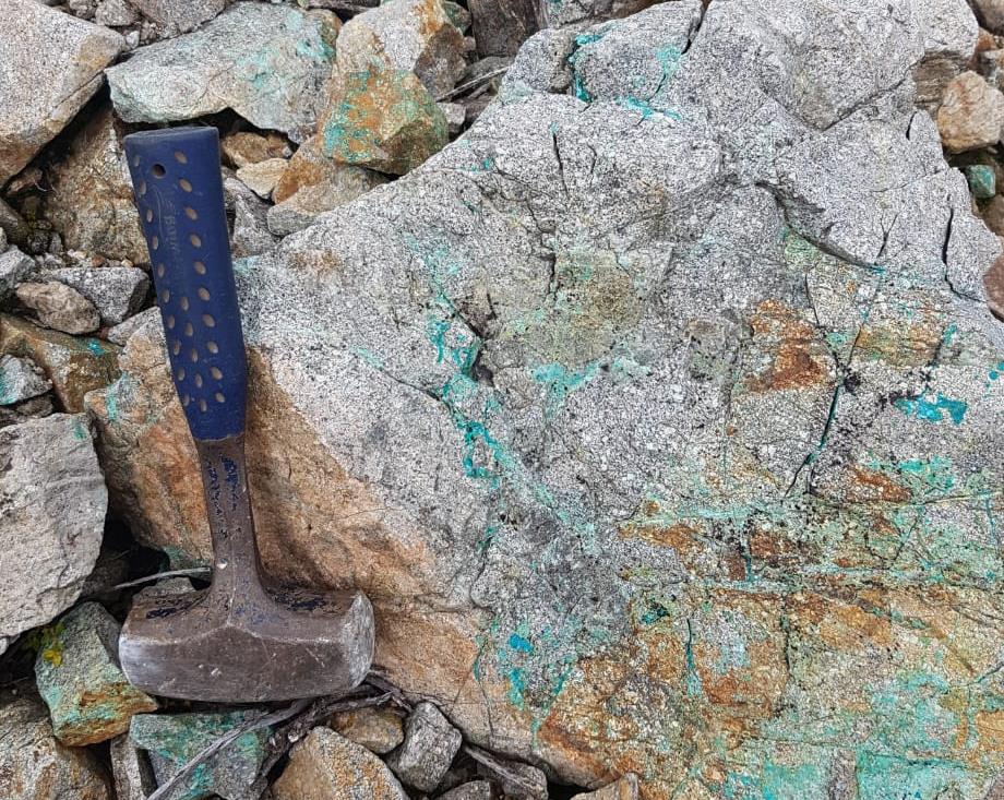
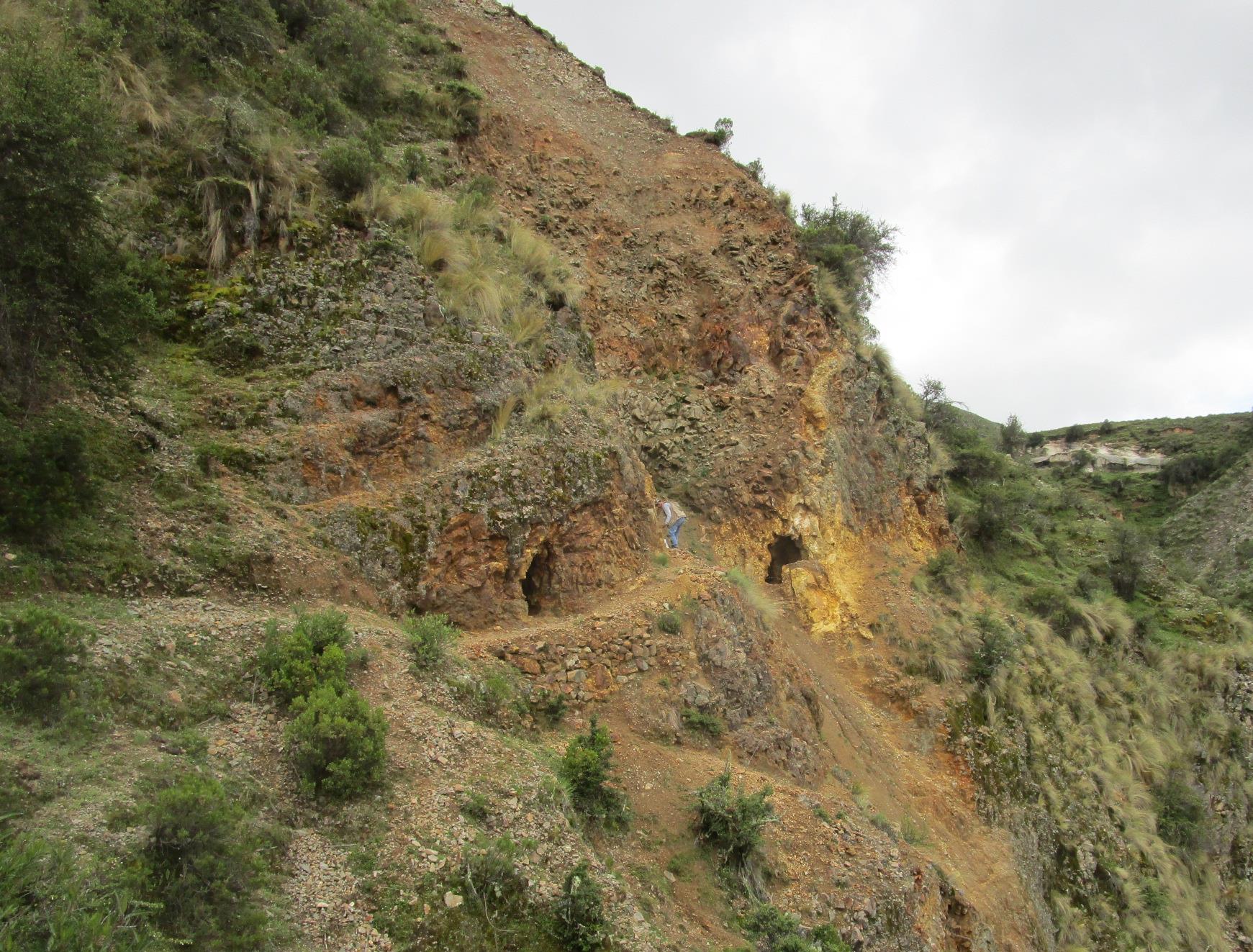
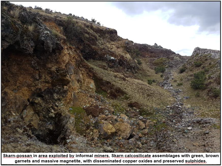
The Cobreorco copper property is approximately 50 sq km in size and was acquired over several years by staking and sealed bid auction, commencing with the acquisition of 1.7 sq km in 2018. An exposed porphyry with intense stockwork and alteration, along with outcroppings of skarn-gossan with massive magnetite-iron oxide, and other calcsilicate minerals that have been exploited on a small scale by artisanal miners led to our interest in this area. Numerous porphyry and skarn related copper-gold occurences are exposed in outcrop, and in small scale artisanal workings, withing the main 2 sq km area of interest.
The project is 100% owned, and not subject to any royalties.
Previous Work:
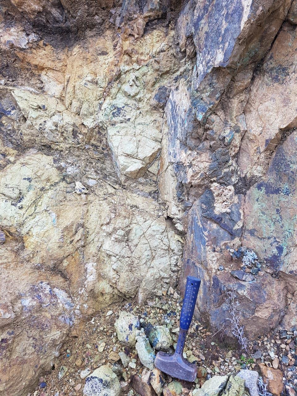
An exposed copper skarn and outcroppings of massive magnetite-iron oxide lead to the staking of this project. In addition, there is a skarn-gossan outcropping that has been exploited on a small scale by artisanal miners. We have found evidence 3 prior drillholes on the project, which we believe were drilled circa 1996, but have not been able to locate the results of this campaign.
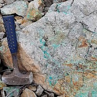
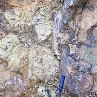
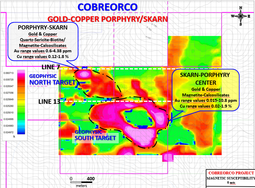
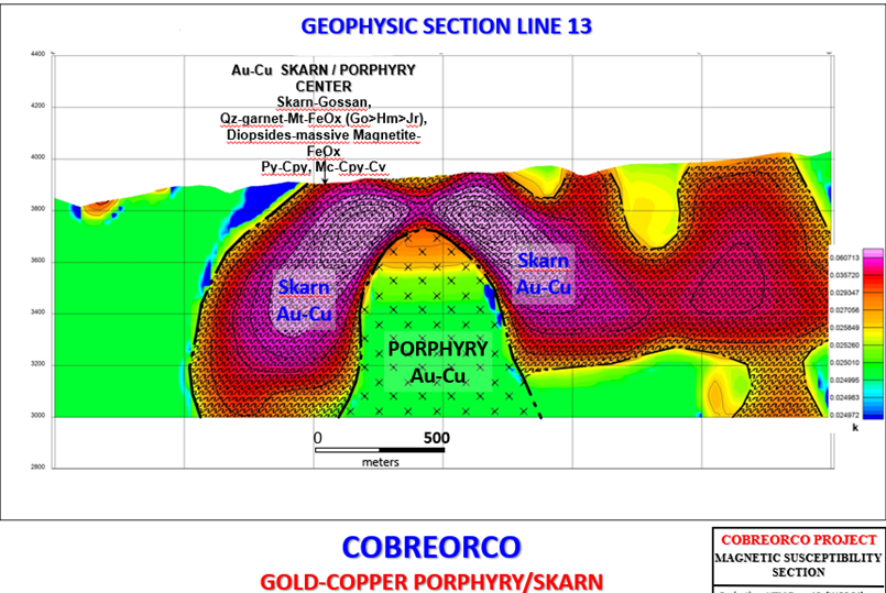
Geology/Mineralization:
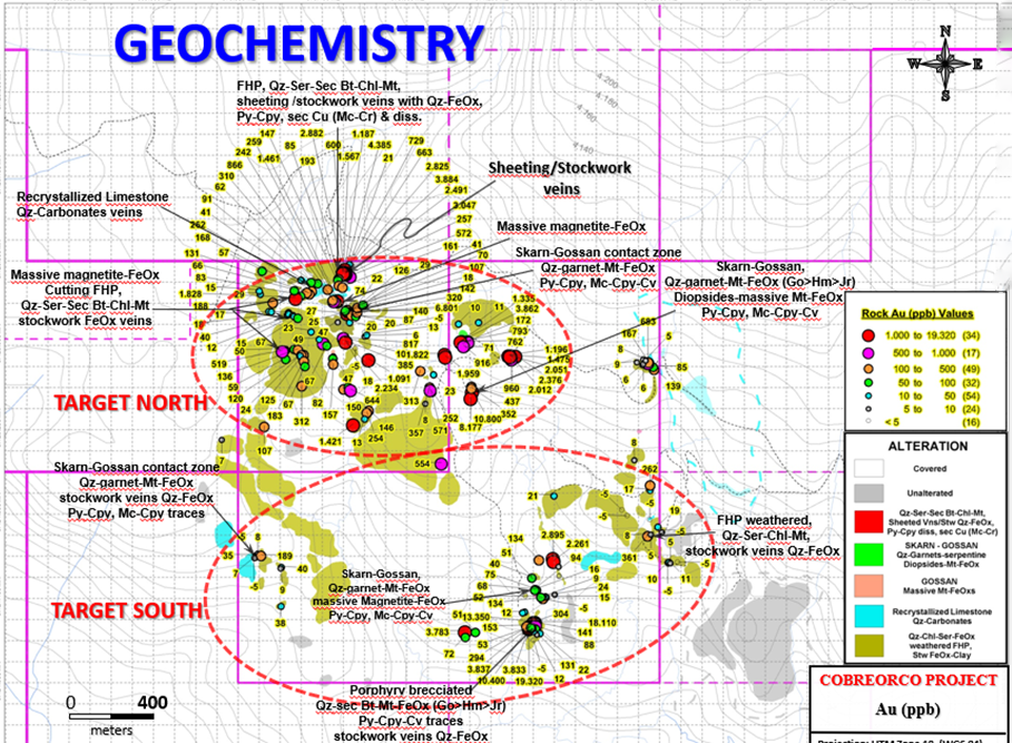
It is the opinion of Condor geologists that Cobreorco is a typical porphyry/skarn system, with large massive magnetite, calcsilicate assemblages with evidence of an eroded skarn, and an outcropping of potasic porphyry, approximately 80 m in diameter. Sampling to date suggests the mineralization of the porphyry is relatively consistent in gold and copper values.
Recent activity:
To date Condor geologists have conducted several sampling programs, and collected 226 samples, typically 2m rock channel samples. A high portion of the samples contained anomalous copper and gold values: 32% contained greater than 1000 ppm copper, and 44% contained greater than 100 ppb gold.
A drone supported magnetic survey was completed in July 2020. The survey covered an area of approximately 5 sq km at a 100 m line spacing for a total of 68 line kms. Data from this survey has been processed, and the initial review of the magnetic survey data suggests the presence of two potential intrusive systems that correlate well with exposed surface gold/copper porphyry and skarn outcrops. The sampling results and analysis of the magnetic survey will be used to design a maiden diamond drill program.
Planned Activities:
Baseline sampling of water, air, and soil has been completed, a requirement for filing our application to the Ministry of Energy and Mines (“MEM”) for a Declaracion de Impacto Ambiental (“DIA”). In paralled with the DIA application, the company is in dialogue with the two local communities that will be required to grant surface access permits for our drill programs. The Participatory Workshops were held in late 2022, and included attendance of officials from the MEM office in Apurimac.
The DIA application was submitted to the MEM in June 2023. Approval of the DIA and the community agreements are expected to take several months to conclude.